
Shannon, Georgia
Shannon, Georgia | |
|---|---|
 Location in Floyd County and the state of Georgia | |
| Coordinates: 34°20′30″N 85°4′47″W / 34.34167°N 85.07972°W | |
| Country | United States |
| State | Georgia |
| County | Floyd |
| Area | |
| • Total | 5.02 sq mi (13.01 km2) |
| • Land | 4.98 sq mi (12.90 km2) |
| • Water | 0.04 sq mi (0.11 km2) |
| Elevation | 696 ft (212 m) |
| Population (2020) | |
| • Total | 1,919 |
| • Density | 385.34/sq mi (148.78/km2) |
| Time zone | UTC-5 (Eastern (EST)) |
| • Summer (DST) | UTC-4 (EDT) |
| ZIP code | 30172 |
| Area code(s) | 706/762 |
| FIPS code | 13-69868[2] |
| GNIS feature ID | 0333013[3] |
Shannon is an unincorporated community and census-designated place (CDP) in Floyd County, Georgia, United States. It is part of the Rome, Georgia Metropolitan Statistical Area. The population was 1,862 at the 2010 census.[4]
History
[edit]The first settlement at Shannon, first called Ridge Valley, then Hermitage, was made in the 1830s.[5]
Geography
[edit]Shannon is located in northeastern Floyd County between Rome and Calhoun, just off Highway 53. According to the U.S. Census Bureau, the Shannon CDP has a total area of 5.0 square miles (13.0 km2), of which 5.0 square miles (12.9 km2) is land and 0.04 square miles (0.1 km2), or 0.86%, is water.[4]
Demographics
[edit]| Census | Pop. | Note | %± |
|---|---|---|---|
| 2000 | 1,682 | — | |
| 2010 | 1,862 | 10.7% | |
| 2020 | 1,919 | 3.1% | |
| U.S. Decennial Census[6] 1850-1870[7] 1870-1880[8] 1890-1910[9] 1920-1930[10] 1940[11] 1950[12] 1960[13] 1970[14] 1980[15] 1990[16] 2000[17] 2010[18] 2020[19] | |||
2020 census
[edit]| Race | Num. | Perc. |
|---|---|---|
| White (non-Hispanic) | 1,700 | 88.59% |
| Black or African American (non-Hispanic) | 59 | 3.07% |
| Native American | 1 | 0.05% |
| Asian | 5 | 0.26% |
| Other/Mixed | 79 | 4.12% |
| Hispanic or Latino | 75 | 3.91% |
As of the 2020 United States census, there were 1,919 people, 784 households, and 546 families residing in the CDP.
2000 census
[edit]As of the census[2] of 2000, there were 1,682 people, 678 households, and 494 families residing in the CDP. The population density was 335.2 inhabitants per square mile (129.4/km2). There were 723 housing units at an average density of 144.1 per square mile (55.6/km2). The racial makeup of the CDP was 95.24% White, 1.19% African American, 0.12% Native American, 0.30% Asian, 0.48% from other races, and 2.68% from two or more races. Hispanic or Latino of any race were 1.25% of the population.
There were 678 households, out of which 29.8% had children under the age of 18 living with them, 57.7% were married couples living together, 11.2% had a female householder with no husband present, and 27.0% were non-families. 22.6% of all households were made up of individuals, and 12.4% had someone living alone who was 65 years of age or older. The average household size was 2.48 and the average family size was 2.91.
In the CDP, the population was spread out, with 23.4% under the age of 18, 7.7% from 18 to 24, 27.8% from 25 to 44, 24.3% from 45 to 64, and 16.8% who were 65 years of age or older. The median age was 39 years. For every 100 females, there were 93.3 males. For every 100 females age 18 and over, there were 89.6 males.
The median income for a household in the CDP was $41,144, and the median income for a family was $42,578. Males had a median income of $30,181 versus $22,000 for females. The per capita income for the CDP was $17,565. About 6.4% of families and 5.8% of the population were below the poverty line, including 6.3% of those under age 18 and 16.9% of those age 65 or over.
Climate
[edit]The climate in this area is characterized by relatively high temperatures and evenly distributed precipitation throughout the year. According to the Köppen Climate Classification system, Shannon has a humid subtropical climate, abbreviated "Cfa" on climate maps.[21]
| Climate data for Shannon, Georgia | |||||||||||||
|---|---|---|---|---|---|---|---|---|---|---|---|---|---|
| Month | Jan | Feb | Mar | Apr | May | Jun | Jul | Aug | Sep | Oct | Nov | Dec | Year |
| Mean daily maximum °C (°F) | 11 (51) |
13 (56) |
17 (63) |
23 (74) |
27 (81) |
31 (88) |
32 (90) |
32 (90) |
29 (84) |
23 (74) |
17 (62) |
12 (54) |
22 (72) |
| Mean daily minimum °C (°F) | −1 (30) |
−1 (31) |
3 (38) |
8 (46) |
13 (55) |
17 (63) |
19 (67) |
19 (66) |
16 (60) |
8 (47) |
2 (36) |
−1 (31) |
9 (48) |
| Average precipitation cm (inches) | 13 (5) |
11 (4.5) |
17 (6.7) |
13 (5) |
11 (4.3) |
9.4 (3.7) |
12 (4.7) |
8.9 (3.5) |
11 (4.4) |
7.1 (2.8) |
9.9 (3.9) |
12 (4.9) |
135 (53.3) |
| Source: Weatherbase [22] | |||||||||||||
Education
[edit]Shannon is in the Floyd County School District.[23] The zoned secondary schools are Model Middle School and Model High School.[24]
Notable person
[edit]- Hal Griggs, baseball player
References
[edit]- ^ "2020 U.S. Gazetteer Files". United States Census Bureau. Retrieved December 18, 2021.
- ^ a b "U.S. Census website". United States Census Bureau. Retrieved January 31, 2008.
- ^ "US Board on Geographic Names". United States Geological Survey. October 25, 2007. Retrieved January 31, 2008.
- ^ a b "Geographic Identifiers: 2010 Census Summary File 1 (G001), Shannon CDP, Georgia". American FactFinder. U.S. Census Bureau. Archived from the original on February 13, 2020. Retrieved April 28, 2016.
- ^ "Floyd County". Calhoun Times. September 1, 2004. p. 77. Retrieved April 24, 2015.
- ^ "Decennial Census of Population and Housing by Decade". United States Census Bureau.
- ^ "1870 Census of Population - Georgia - Population of Civil Divisions less than Counties" (PDF). United States Census Bureau. 1870.
- ^ "1880 Census of Population - Georgia - Population of Civil Divisions less than Counties" (PDF). United States Census Bureau. 1880.
- ^ "1910 Census of Population - Georgia" (PDF). United States Census Bureau. 1910.
- ^ "1930 Census of Population - Georgia" (PDF). United States Census Bureau. 1930. pp. 251–256.
- ^ "1940 Census of Population - Georgia" (PDF). United States Census Bureau. 1940.
- ^ "1950 Census of Population - Georgia" (PDF). United States Census Bureau. 1950.
- ^ "1960 Census of Population - Population of County Subdivisions - Georgia" (PDF). United States Census Bureau. 1960.
- ^ "1970 Census of Population - Population of County Subdivisions - Georgia" (PDF). United States Census Bureau. 1970.
- ^ "1980 Census of Population - Number of Inhabitants - Georgia" (PDF). United States Census Bureau. 1980.
- ^ "1990 Census of Population - Summary Social, Economic, and Housing Characteristics - Georgia" (PDF). United States Census Bureau. 1990.
- ^ "2000 Census of Population - General Population Characteristics - Georgia" (PDF). United States Census Bureau. 2000.
- ^ "2010 Census of Population - General Population Characteristics - Georgia" (PDF). United States Census Bureau. 2010.
- ^ Cite error: The named reference
2020CensusP2was invoked but never defined (see the help page). - ^ "Explore Census Data". data.census.gov. Retrieved December 12, 2021.
- ^ Climate Summary for Shannon, Georgia
- ^ "Weatherbase.com". Weatherbase. 2013. Retrieved on September 28, 2013.
- ^ "2020 CENSUS - SCHOOL DISTRICT REFERENCE MAP: Floyd County, GA" (PDF). U.S. Census Bureau. Retrieved June 25, 2021.
- ^ "School Distrist's(sic) Feeder Patterns". Floyd County School District. June 1, 2008. Archived from the original on June 1, 2008. Retrieved July 16, 2022.
External links
[edit]- Hermitage historical marker
Municipalities and communities of Floyd County, Georgia, United States | ||
|---|---|---|
| Cities | 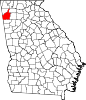 | |
| CDPs | ||
| Unincorporated communities | ||